Wednesday 15 September 2010

Ceibwr to St Dogmael's

Stage 22: 7 miles in about 3.5 hrs on Sunday 12th September

Well here it is then, the last few miles of the Coast Path. I didn't think I'd get this far this year, but somehow things seemed to accelerate after rounding St David's Head and today's walk sees me out of Pembrokeshire (for a very short distance into Ceredigion) before the end at St Dogmael's. But I get ahead of myself, first there was the walk.....


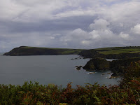
Looking back along the coastline from Ceibwr I could see as far as Garn Fawr on Strumble Head, while in front of me were the crumpled cliffs which would lead to Cemaes Head, and the River Teifi estuary. To be honest, apart from one enormous climb, which took me from sea level to the highest point on the entire path (575ft), this was not my most memorable walk. Perhaps the problem was that there was only about 3 miles on 'proper' path, while the bulk of the rest was on road, albeit to start with a very quiet lane. However, the cliff erosion was, as ever, spectacular and diverting.


In no time at all I found myself on Cemaes Head, now occupied by a nature reserve which tops the cliffs at the southern end of the mouth of the Teifi. To the north was Cardigan Island and the magnificently located Cliff Hotel at Gwbert. On my way across the reserve a man stopped to ask me if I'd seen anything, clearly taking me for more of a wildlife expert than I actually am. I explained about the seals I'd just seen and rushed on before I got into discussion way out of my depth about birds, or small mammals.

Then it was on towards Poppit Sands, with the lane leading through a farmyard where a goat was walking along the front garden wall.

On one side of the farmtrack was a yurt with both a chimney and two solar panels, while on the other side was a small pond with surrounding woodland.


In here I could make out coloured bells hanging on the trees. Perhaps they were lanterns although I couldn't see any wire strung between individual bells.


A gentle mile and a half meander downhill, past the Youth Hostel, brought me to Poppit Sands, which comprises not a lot more than a Lifeboat Station, cafe, campsite, public toilets, beach and sand dunes.


But also, perhaps more significantly for me, a plaque marking the opening of the Coast Path walk by Wynford Vaughan Thomas in 1970. This Poppit plaque says 180 miles to Amroth. Confused by the mileages? Me too. The starting plaque at Amroth says 186 miles to St Dogmael's (which is 1.5 miles from Poppit). Worse, the sum of my walks (even allowing for my failure to add up correctly) is 179 miles. I take heart from the fact that the official Pembrokeshire Coast Park Authority distances leaflet gives only 179.6 miles from one to t'other. I believe the extra mileage is accounted for by the high tide diversions at Sandy Haven and Dale (walk 11, Milford Haven to Dale). At any rate I know I walked every step, so I shall try not to be too obsessive about this.

At St Dogmael's (after passing briefly through a small bit of the adjacent county of Ceredigion) this lovely mosaic waited for me - 300K!! Now that's more like it.


Adjacent to the mosaic is an unusual pillar which shows the main coastal Pembrokeshire towns, together with the sort of wildlife which can be seen along the path - most of which I did see.

So that's it. It's been a heck of a journey for this non-walker, which inspires me to get out walking more, and also to try to learn more about natural history, geology and much more.


The route was easy to follow, thanks to the acorn waymarking signs. I met some charming people along the way, though what they made of me in my Where's Wally get up (cap, binoculars, shorts, walking boots - you get it), I don't know.


My favourite bit? - I don't know this either, so much was breathtaking. I shall certainly revisit some places, for instance Caerfai -St David's Head (must climb Carn Llidi). Also Pwll-deri, close to Strumble Head. And Druidstone Haven - Newgale. And we've already been back to Castlemartin Range East (Green Bridge of Wales). So many..... Perhaps next year I'll have to walk it all anti-clockwise, if only to find the sign (somewhere near West Dale I think) which I failed to photograph: 'The sheep have found out how to open the kissing gate. Please use the string.'

Only in Pembrokeshire....

Friday 10 September 2010

Newport to Ceibwr bay

Stage 21: 8 miles in just under 4 hours on 9th September

Before I started the walk, I retraced my steps at the end of the last walk (when, I have to admit, I was shattered) to see Carreg Coetan Arthur - a small cromlech nestling amongst a new housing development. Although prehistoric, it has a 21st century suburban air about it - I think it's the snooker-table grass and clipped hedge which bothers me.


Then it was off over Newport's Iron Bridge, along the river bank, past a limekiln (naturally) and across the golf course to Newport Sands. It's a bit nerve-wracking crossing a golf course when there are players within view actually wielding clubs. I am not familiar with golfing vs public footpath etiquette, but it seemed they were happy for me to have right of way.


On this side of the River Nyfer estuary, a few people were wandering in the surf along the beach - - also known as the Bennet - and the car park was starting to fill up. On the other side the boats in the distance at the Parrog which, on the previous day's walk, had been lying on their sides on the mud at low tide, were all upright and in neat rows in today's high tide.

Neither of my guidebooks, while otherwise informative, has given much information till now on the ups and downs of the path. I assume the authors just strode along in an aura of fearsome fitness. However for today's walk both were quite unambiguous: there were going to be some steep climbs. So I braced myself and got going. Sometimes when you do that, it's not quite as bad as you anticipate, and this was one of those times - or perhaps I am just a little fitter than I was setting off from Amroth.

It's difficult to take a good photo of steepness, but here a farmer is herding his sheep on his quadbike (arrowed) on the almost vertical slope up to Pen y Bâl. He stopped to pass the time of day with the walkers ahead of me, so I had a chance to take a pic. The path follows inside the line of the fence (lhs) and is a mixture of steps and stones. In a way I found the descents today more difficult, and certainly more hair-raising than the ascents. The last few days' rain had made everything muddy and skiddy.

A beacon, presumably for shipping, marked the top of the climb and I had a fantastic view back to Dinas Island. By now the weather had turned amazing - hot, hot sunshine.


The path ran along (and up and down in accord with the predictions) the top of very high cliffs, whose slopes were mostly covered with rusty bracken. Because the tide was up, any beaches were minimal, but looking back I spotted this arch at Bwn Bach. Out of the corner of my eye, I also caught the Strumble Head lighthouse winking at me in the far, far hazy distance. It had been out of sight for miles, but now reappeared.


There aren't a huge number of stiles along the path, as the National Park Authority has been kindly replacing them with gates. However I did meet one family with a conundrum. Dad had a baby in a rucksack thing on his back. Mum was in charge of a large lurcher-type dog, which could or would not get over / under / round the stile. I offered to help lift him over, but they assured me he would be too heavy. The only solution I could see (apart from giving up!) would be to load the dog in the baby carrier and give Mum the baby to hold, but I didn't offer this gem of advice .... I clambered over the stile and left them to it.

Pwll -y-Wrach, the Witch's Cauldron, is the chaotic result of insistent Atlantic waves - a collapsed blowhole with an arch over which the Coast Path goes. There is a small beach made of horizontal slate beds, made smooth by the relentless tides. Impossible to describe in less than superlatives - spectacular!


From here it was a fairly short walk to Ceibwr bay, my destination for the day. But there were still more rocks to gawp at, another arch to admire and, ahead of me, cliffs with complex zig-zag patterns of erosion.


Laid out on the grass before Ceibwr was this pattern made of small slatey pieces. I wish I could be as artistic!


At the end of my walk I searched out another cromlech not far away - Llech Tri-bedd (Three graves slab). It rounded off the day in excellent fashion - suitably wild and untamed.

Wednesday 8 September 2010

Fishguard Fort to Newport

Stage 20: 11.5 miles on 7th September, taking about 5.5 hours

I took a chance that the weather forecast for sharp showers was pessimistic and was proved wrong. Almost the moment I got off the bus (the 'Poppit Rocket', for the first time), the black clouds welled up and spilled over. Coat on, fleece off. Sun out. Coat off. Rain again. Coat on, and so on until I'm nearly driven demented and contemplate not bothering with the coat, instead getting my T-shirt wet and allowing it to dry in situ. Perhaps better not: not sure my public is ready for this kind of revelation. After a bit, though, the rain got fed up with the game and sulked in a big black cloud over Newport, while I enjoyed sunshine walking towards it. With spectacular precise timing, the heavens opened as I arrived at Newport Yacht Club, so I could shelter there. Gotcha! However, I was humbled by the number of people on the path I met today who had walked on Monday in the solidly pouring rain. Being a native of hereabouts I only went outside once that day, to put rubbish in the green bin. The visitors are obviously made of sterner stuff (and / or have more Gore-tex to their names).


Fishguard Fort was built
in the late 18th Century to protect the town from pirates / buccaneers / privateers and, when the French threatened to invade in 1797 (see my previous blog), a cannon was fired. This put the French off so much they turned tail and went to find the alternative landing site at Carregwastad. The fort played no further part in repelling the invasion - it only had three gunners to man the battery.

The coastline between Fishguard and Newport shows rather different patterns of erosion from other parts of the coast I've so far travelled along: the cliffs are battered and stripy as ever, but at the foot often lie large areas of almost flat rock. Sometimes there are slashes and indentations which look as if a lunatic has been at large with a carving knife. Many of the bays I passed are inaccessible except from the sea, but they weren't frequented by seals, presumably as there was not enough shelter. I only saw one seal all day, and that was in the lee of Pen Dinas.


On a ledge on a vertical cliff of one of these bays I spotted a young seagull being encouraged to fly by its parent. The conversation was going like this: Parent Gull: Go on son, just flap your wings and jump. Young Gull: I can't (mewing). PG: Of course you can, close your eyes. YG: No, I can't, I'll fall (very squeaky). PG: Father, come here and tell Junior it's simple... I watched for a while, but Junior wouldn't do it, even with both adults screaming at him. A couple of times on these walks I've passed fields where there are a large number of adult and young gulls assembled and interpreted it as a flying school - lessons in how to lift a tuna sandwich and so on. The parent gulls appear to have very limited patience with their young, who in turn are a whining bunch.


All morning I walked towards Dinas Island, which looks like a whale rising from the sea. It's
not an island (yet) - it looks like one, but is still joined on to the mainland, just.


The beach at Pwllgwaelod, some five miles walking from Fishguard, directly faces the port across the bay, and also lies at the foot of Pen Dinas, the 'whale's head' on Dinas Island. The small pub across the road from the beach used to be named The Sailors' Safety, as it kept a light on for boats to find safe harbour. But now it's called The Old Sailor - having lost any connotations of after hours drinking. After the steep descent to reach it, it was tempting to call in and dry my clothes out properly, but I needed to conquer Pen Dinas / Dinas Head, rearing its head behind it. I dutifully toiled up the 465 feet to the triangulation point and admired the magnificent views in all directions.


On the descent from Pen Dinas, you pass Needle Rock (the second of this name within 5 miles of each other) and this is where I saw my lone seal today. The rock's name comes from the fact that it has a natural arch, but search as I did, I totally failed to see it. This picture also shows the rain cloud over Newport in the distance.


At the other side of Dinas Island from Pwllgwaelod is the small village of Cwm-yr-Eglwys, where the beach directly faces Newport. The little church there was mostly washed away in 1859 on the night when the ship the Royal Charter sank, along with another 110 or so ships off the coastline of Wales. All that remains is the belfry wall and some of the graveyard - further damage was caused to this in a storm in 1979.


And so on to Newport, passing some very eroded cliffs, and all the time keeping an eye on Carn Ingli, one of the Preseli Hills, which towers over the town.


The tide was way, way out when I arrived at Newport Parrog (the main harbour), with boats lying every which way on their sides on the mud. The river Nyfer winds through the harbour, separating the Parrog from the beach called Newport Sands.

Sunday 5 September 2010

Strumble Head to Fishguard Fort

Stage 19: 8.5 miles in 5 hours on 2nd September

After all the time it took for me to reach Strumble Head lighthouse on the previous stage, you'd have thought it would hang about longer before waving goodbye, but it disappeared within 10 minutes of my starting out today. For the first time since the Milford Haven waterway, I was now travelling eastwards.


To start with there seemed to be one or more young men fishing on the end of every rocky promontory . However, on passing the fourth or fifth, I noticed that the human fishermen had been replaced by a cormorant - probably just as or more efficient at its work.


At Porthsychan beach a few couples (together with flasks and small dogs) had gathered to watch a seal. The seal was duly performing to its audience, alternately sunbathing in the shallows and then diving from view. You can just about make it out in this pic at the lower right hand corner, just above the stick. Getting a telephoto lens for the camera suddenly seemed a brilliant idea, but get real: I wouldn't have a clue how to use it.


Later, from the clifftops above the more isolated Aber-Felin bay, I saw many more seals. In one cove there were four adults in the water, and a pup flopping about on the beach - the first one I've see this year. Such excitement, I had to tell the next pair of walkers coming towards me about it! I noticed the lady was looking very pale and not at all interested. Then she told me she'd just nearly stepped on an adder.

Another pair of walkers (slightly more elderly than me) told me that they had absconded from their coach tour as the weather was too brilliant to be stuck inside a bus all day. When eventually I reached Goodwick and descended to the entrance of the Fishguard Bay Hotel, there was the 'Happy Days' coach parked up. My new found friends were still out on their own happy day, I imagine. It certainly must have been an energetic day for them; the way was definitely undulating, if not grumbulatory.

About halfway between Strumble Head and Fishguard at Carregwastad is a standing stone which commemorates the last invasion of Britain in 1797. The French army was led by an Irish-American and failed miserably in its ambition. Jemima Nicholas, a local cobbler from Fishguard and her women friends were said to have seriously worried the invading soldiers by appearing on the clifftops dressed in their traditional red flannel skirts and black high bonnets, looking for all the world like British soldiers. Jemima herself captured 12 Frenchmen. After the women's heroics and those of the local militia, the French surrendered. To celebrate the bicentenary of the victory, the story of the whole episode was woven into a tapestry which is now on display in Fishguard. The tapestry is the same length as the Bayeux one and tells a tale no less dramatic.

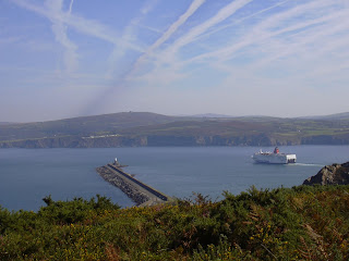
Fishguard ferry port is actually at Goodwick, the other side of the bay from the town. As I arrived the Stena Line ferry was leaving for Ross-lare. Clearly a lot of aeroplanes were also on their way across the Irish Sea too, heading for the Atlantic.


Then it was down a zig-zag steep path through woodland, over an exciting metal boxed in bridge, and away from the port.


It hadn't occurred to me before that there would be a sandy beach in both Goodwick bay and Lower Fishguard Harbour (the old port), but there were. Above the latter there were the obligatory limekilns.

Fishguard Lower Harbour is in a different aesthetic league from the ferry port.


Total walked: 151 miles of 186

Wednesday 1 September 2010

Abercastle to Strumble Head

Stage 18: 10 miles plus climb of Garn Fawr, taking 6hrs in all on 31st August

From Strumble Head, where I parked, the Strumble Shuttle bus takes a route through the narrowest of lanes, following all sorts of diversions and excursions. At one point I noticed us passing a sign - 'No Coaches' - well that's all right then, this is a fully fledged 23-seater BUS. Rather against my expectations, it deposited me safely at Abercastle just before midday in glorious Pembrokeshire sunshine.

The little harbour boasts a plaque celebrating the achievement of famous inhabitant Alfred 'Centennial' Johnson, who single handedly sailed across the Atlantic from West to East in 1876. In those days Abercastle was a bustling, important port. Now it is a sleepy picturesque village with mostly holiday-let cottages.


I headed off up to the cliff tops and once again walked past countless coves, only accessible from the sea, and looked down on the often needle-sharp rocks which poke their noses up all along the coastline. The clarity of the water meant almost as much was visible below the surface as above. In almost every bay where there was some kind of beach I could see one or two seals loafing about in the shallows, probably waiting for the mothers to give birth - I saw no pups.

A couple of kayakers were making their way along in the same direction as me, but I couldn't keep up: what a way to see all the caves and crevices which are concealed from the cliff-walker.

The beach at Aber Mawr, where I ate my sandwiches, is long and pebbly, though apparently it wasn't always like this - 140 years ago a storm threw up the pebbles here as well as on its baby brother, Aber Bach about 250 yards further on. Brunel originally chose Aber Mawr for the location of his Irish embarkation port, and indeed started construction work there, before changing his mind and chosing Neyland in the Milford Haven waterway instead. Aber Mawr was also the terminus for the
first Atlantic submarine telegraph cable in 1873.

Pwllcrochan beach can only be reached by boat although, if one of my guidebooks is to be believed, there was, perhaps is still, a rope down which the intrepid explorer can absail to the bay beneath. I never shone at rope climbing in the gym at school (never did reach the top of a rope), so I had already promised myself this was not a diversion I was going to make. Discretion is, as Roger McGough would have it, the better part of Valerie. Instead, I gawped at the tortured rocks and watched the youngsters cavorting in the waves beneath me.

From Pwllcrochan the path climbs up on to a rocky ridge, which the map doesn't even grace with a name. The greyish white rocks here are typical of all this stretch of coast, from about Caerfai, close to St David's. On my left, the sea was far, far below - some 400ft - while to my right cows were grazing about a field's width away. So, despite feeling as if I were alone on this ridge in the Himalayas, I wasn't really.


An open stone shelter - like an animal pound - had been built on one summit while a cairn had been placed on another, presumably as a guide to boats, around this rocky, treacherous part of the Strumble peninsula - the headland beneath (Penbwchdy) has been the cause of many a shipwreck.

Civilisation was on the horizon I could tell - a well-placed bench (no plaque on this one) forewarned the intrepid explorer - and I was shortly looking down on Pwllderi bay. The caves, fissures and small rocky islands combine to make the bay very picturesque.


In front of me all the way along the rocky, boulder-strewn path had loomed Garn Fawr, at 700ft the highest 'peak' in this area. By the time I arrived at the white cottage at its base I had decided: I would clamber up, just because I could. (The lower white house in the picture is a youth hostel).


As expected, the views in every direction from the rocky peak were panoramic and I would have spent longer there had there not been about a million flying ants protecting the trig stone. Stone walls outlined enclosures on the summit, which I interpreted as part of the prehistoric fort marked on the map.


Rather touchingly in the ruins of a lookout hut is a stone inscribed with two WW1 names, and nearby another with the names of the two builders. Close by is a compass engraved on a boulder - not wholly necessary, I feel, as even I knew that Strumble Head lighthouse is pretty well exactly due north! And if the lookouts couldn't see the lighthouse about a mile away, how on earth would they see invaders coming from the west? A cold, lonely spot which didn't see much action is probably the answer.


The lighthouse might be a mile away as the proverbial crow / gull would find it, but along the path there was still about 3 miles. It was a stony and what I call 'grumbulating' route, as the lighthouse - which has the air of the sort of birthday candle you can't blow out - seemed to take an unconscionable time to reach (actually about 1½ hours).

I guess even a cairn needs sunglasses - and the colour scheme matches the heather!


Total walked: 142.5 out of 186