Well here it is then, the last few miles of the Coast Path. I didn't think I'd get this far this year, but somehow things seemed to accelerate after rounding St David's Head and today's walk sees me out of Pembrokeshire (for a very short distance into Ceredigion) before the end at St Dogmael's. But I get ahead of myself, first there was the walk.....
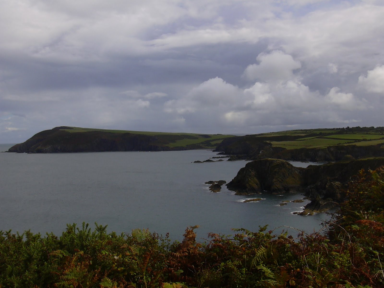
 Looking back along the coastline from Ceibwr I could see as far as Garn Fawr on Strumble Head, while in front of me were the crumpled cliffs which would lead to Cemaes Head, and the River Teifi estuary. To be honest, apart from one enormous climb, which took me from sea level to the highest point on the entire path (575ft), this was not my most memorable walk. Perhaps the problem was that there was only about 3 miles on 'proper' path, while the bulk of the rest was on road, albeit to start with a very quiet lane. However, the cliff erosion was, as ever, spectacular and diverting.
 In no time at all I found myself on Cemaes Head, now occupied by a nature reserve which tops the cliffs at the southern end of the mouth of the Teifi. To the north was Cardigan Island and the magnificently located Cliff Hotel at Gwbert. On my way across the reserve a man stopped to ask me if I'd seen anything, clearly taking me for more of a wildlife expert than I actually am. I explained about the seals I'd just seen and rushed on before I got into discussion way out of my depth about birds, or small mammals.
Then it was on towards Poppit Sands, with the lane leading through a farmyard where a goat was walking along the front garden wall.
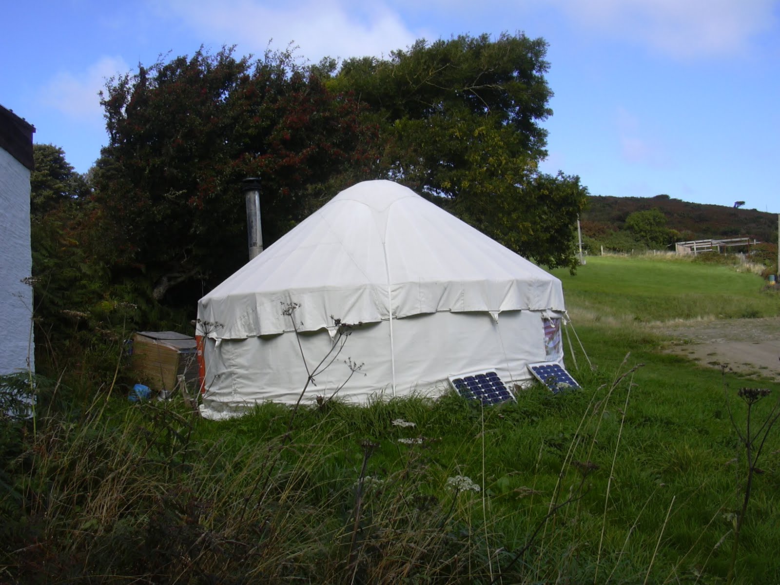 On one side of the farmtrack was a yurt with both a chimney and two solar panels, while on the other side was a small pond with surrounding woodland.
In here I could make out coloured bells hanging on the trees. Perhaps they were lanterns although I couldn't see any wire strung between individual bells.

A gentle mile and a half meander downhill, past the Youth Hostel, brought me to Poppit Sands, which comprises not a lot more than a Lifeboat Station, cafe, campsite, public toilets, beach and sand dunes.

But also, perhaps more significantly for me, a plaque marking the opening of the Coast Path walk by Wynford Vaughan Thomas in 1970. This Poppit plaque says 180 miles to Amroth. Confused by the mileages? Me too. The starting plaque at Amroth says 186 miles to St Dogmael's (which is 1.5 miles from Poppit). Worse, the sum of my walks (even allowing for my failure to add up correctly) is 179 miles. I take heart from the fact that the official Pembrokeshire Coast Park Authority distances leaflet gives only 179.6 miles from one to t'other. I believe the extra mileage is accounted for by the high tide diversions at Sandy Haven and Dale (walk 11, Milford Haven to Dale). At any rate I know I walked every step, so I shall try not to be too obsessive about this.
 At St Dogmael's (after passing briefly through a small bit of the adjacent county of Ceredigion) this lovely mosaic waited for me - 300K!! Now that's more like it.
Adjacent to the mosaic is an unusual pillar which shows the main coastal Pembrokeshire towns, together with the sort of wildlife which can be seen along the path - most of which I did see.
So that's it. It's been a heck of a journey for this non-walker, which inspires me to get out walking more, and also to try to learn more about natural history, geology and much more.
 The route was easy to follow, thanks to the acorn waymarking signs. I met some charming people along the way, though what they made of me in my Where's Wally get up (cap, binoculars, shorts, walking boots - you get it), I don't know.
 My favourite bit? - I don't know this either, so much was breathtaking. I shall certainly revisit some places, for instance Caerfai -St David's Head (must climb Carn Llidi). Also Pwll-deri, close to Strumble Head. And Druidstone Haven - Newgale. And we've already been back to Castlemartin Range East (Green Bridge of Wales). So many..... Perhaps next year I'll have to walk it all anti-clockwise, if only to find the sign (somewhere near West Dale I think) which I failed to photograph: 'The sheep have found out how to open the kissing gate. Please use the string.'
Only in Pembrokeshire....